
Quick Links
Contacts
http://transnzoia.go.ke
countyoftransnzoia@gmail.com
@@Trans_NzoiaGov
(054)30301/ (054) 30302
P.O. Box 4211-30200, Kitale
About Trans-Nzoia County
General Information
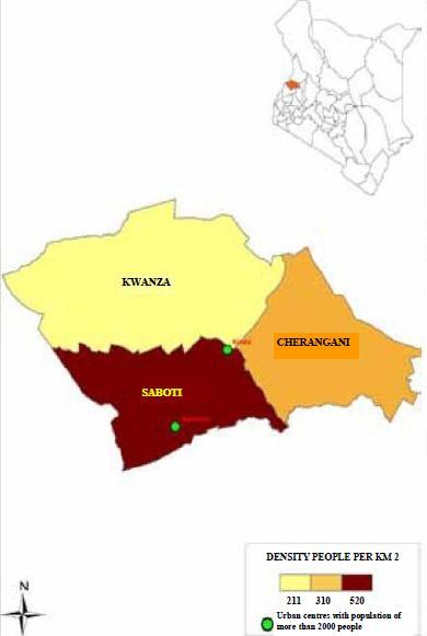
Trans Nzoia County is located in the former Rift Valley Province, it borders the Republic of Uganda to the North West, and the following counties; West Pokot to North, Elgeyo Marakwet to the East, Uasin Gishu and Kakamega to the South, and Bungoma to the West and South West.Area (Km 2): 2,495.5 Km2 Climate/Weather: Temperatures range from a mean annual minimum of 10°C to a mean maximum of 37°C, with average rainfall amounts of 11,200mm per annum. Road Network: Bitumen Surface (59.2 Km), Gravel Surface (135 Km), Earth Surface (306.5 Km) Key National Monument(s): Kitale Museum, Mt. Elgon National Park, Saiwa Swamp National Park Population: 818,757 (Male - 50 %, Female - 50 %) Population Density: 328 people per Km2